
How to Make a Site Plan for Permit Approval and Construction

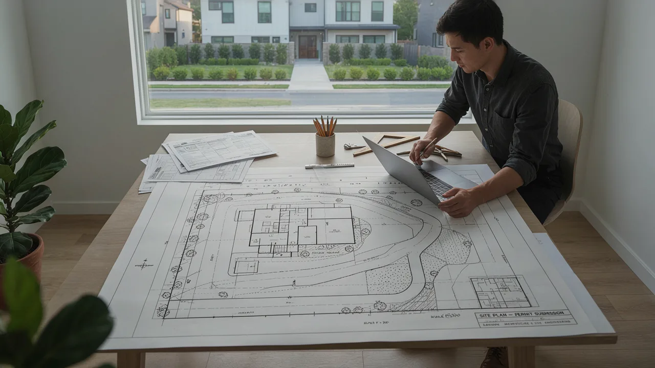
Getting a construction project approved often starts with one essential document: a site plan. Whether you are planning a new home, addition, garage, deck, pool, fence, or other property improvement, local authorities may require a clear drawing that shows exactly what you intend to build and where it will be located.
If you are wondering how to make a site plan for permit, the process is easier when you understand what information must be included and how the drawing should be prepared. A well-organized site plan helps building departments evaluate zoning requirements, setbacks, access, drainage, utilities, and the relationship between your proposed project and the surrounding property.
This guide explains the main steps for creating a reliable site plan for building permit approval and preparing your property information for construction.
1. Understand What a Site Plan Needs to Show
Before drawing anything, understand the purpose of the site plan. A permit site plan is more than a simple sketch of your property. It is a scaled drawing that communicates existing and proposed conditions to reviewers, contractors, designers, and other professionals.
The exact requirements vary by city, county, and project type. However, most permit plans need to identify the property boundaries, existing structures, proposed construction, dimensions, setbacks, access points, and important site features.
Depending on the project, you may also need information about utilities, parking, drainage, landscaping, easements, fences, trees, septic systems, wells, or grading.
Start by checking the requirements of the local building or planning department. Knowing these requirements before preparing the drawing can prevent missing information and reduce the risk of submitting an incomplete application.
2. Gather Accurate Property Information
The quality of your site plan depends heavily on the accuracy of the information you start with. Collect as much reliable property information as possible before creating the drawing.
Useful documents may include a property survey, deed, previous site plans, plot plan, parcel information, architectural drawings, zoning documents, or measurements taken from the property.
Identify the overall lot dimensions and locate existing features such as:
- Property lines and corners
- Existing house or buildings
- Driveways and sidewalks
- Streets and public access
- Fences and walls
- Pools, sheds, decks, or patios
- Trees and other significant site features
- Utility connections
- Easements and right-of-way areas
Do not rely on estimates when precise measurements are available. Even a small dimensional error can affect setback calculations or the location of a proposed structure.
If you do not have reliable measurements, consider obtaining a professional survey or other suitable site information before preparing the final plan.
3. Choose the Correct Scale and Draw the Existing Site
Once the property information is collected, establish a suitable drawing scale. A scale allows the reviewer to understand the relationship between different features on the property.
For example, a site plan might use a scale such as 1 inch representing 20 feet, depending on the size of the property and the local requirements. The important point is that the scale should be clearly identified and used consistently.
Begin by drawing the property boundaries. Then add existing structures and other important features in their correct locations.
Include the street or road along the appropriate property boundary and identify the property's address. A north arrow should also be shown so reviewers can understand the orientation of the site.
At this stage, your drawing should provide a clear picture of the existing conditions before the proposed project is added.
4. Add the Proposed Construction and Required Dimensions
The next step is to show exactly what you intend to build. This is one of the most important parts of a site plan for building permit approval.
Clearly identify the proposed structure and distinguish it from existing structures. For example, if you are adding a detached garage, show its proposed footprint and location relative to the property boundaries and existing home.
Include important dimensions such as:
- Overall building dimensions
- Distance from property lines
- Front, rear, and side setbacks
- Distance from existing structures
- Driveway or access dimensions
- Parking areas where applicable
- Distances to other relevant site features
Setbacks are particularly important because local zoning regulations often specify minimum distances between buildings and property lines.
Make sure dimensions are easy to read and do not overlap other information. The reviewer should be able to determine the proposed structure's location without having to interpret a confusing drawing.
5. Include Site Details Required for Permit Review
Different projects require different levels of detail. A basic residential project may need a relatively simple site plan, while larger construction or development projects can require substantially more information.
Depending on your jurisdiction and project, the plan may need to identify drainage patterns, grading, stormwater features, utilities, landscaping, parking, fire access, accessibility features, or environmental constraints.
Existing and proposed utilities can also be important. Show relevant water, sewer, electrical, gas, or other utility information when required by the permitting authority.
If the project changes the ground surface significantly, grading and drainage information may become especially important. Poorly documented drainage can create problems during construction and may affect neighboring properties.
It is also important to identify easements, rights-of-way, flood-related restrictions, or other limitations that affect how the property can be developed.
The goal is not to put unnecessary information on the drawing. Instead, include the information needed to demonstrate that the proposed project complies with applicable requirements.
6. Review, Format, and Submit Your Permit Site Plan
Before submitting your permit plans, perform a detailed quality check. Compare the drawing with the requirements published by the relevant local authority.
Confirm that the site plan includes the correct property address, scale, north arrow, dimensions, existing conditions, proposed construction, setbacks, and other required information.
Check that the measurements are consistent throughout the drawing. For example, the building dimensions should correspond with the distances shown to property lines. Labels should be readable, and existing and proposed features should be clearly distinguished.
If your jurisdiction requires a particular paper size, file format, professional seal, survey information, or additional documents, follow those requirements carefully.
For complex projects, working with an architect, engineer, surveyor, or professional drafting service can be a practical way to improve accuracy and ensure the drawings meet local expectations.
Once the plan is complete, submit it through the process specified by your city or county. The building department may review the drawing for zoning, building, planning, engineering, or other applicable requirements.
Make Permit Approval Easier With a Well-Prepared Site Plan
Learning how to make a site plan for permit approval is an important step for homeowners and property owners planning construction. A good site plan clearly communicates the existing property conditions, proposed improvements, dimensions, setbacks, access, and other information needed for review.
The most important principle is accuracy. Start with reliable property information, use a consistent scale, show existing and proposed features clearly, and check the requirements of your local jurisdiction before submitting the application.
A carefully prepared site plan for building permit approval can make the review process easier, reduce avoidable corrections, and give contractors a clearer understanding of the project.
If you need professional assistance preparing drawings for your property project, SitePlans.online can help you create clear, practical site plan documentation for permit and construction needs.
0 comments
Log in to leave a comment.
Be the first to comment.